From pv magazine 09/2021
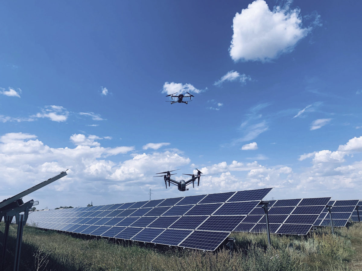
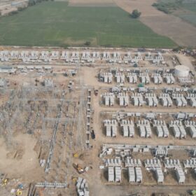
The efficacy of drones is perhaps nowhere more demonstrable than in comparison to handheld thermal inspections. Without drone accessibility, solar technicians have to walk the rows of solar farms with handheld thermal cameras in order to manually collect data, or at least, collect the data they can reach. This is no small task considering the size of some solar farms, but it’s only a small buzz for a drone capable of carrying normal visual, thermal or electroluminescence (EL) imaging cameras.
Jesse Stepler, president and co-founder of Measure Global, a U.S.-based aerial intelligence company that builds software to automate drone operations, told pv magazine that drone technology has made “massive advancements” in recent years. Stepler added that given the U.S. solar industry’s current growth rate, there will only be more demand for inspections, and these inspections are only becoming more “seamless.”
India-based solar drone inspection firm AirProbe reports that more O&Ms and IPP’s are “jumping into the picture with in-house drone operations as the cost of drones lowers with new models coming into the market every year.” The reason being that, by utilizing drones with normal visual and infrared cameras integrated with AI algorithms, project developers and managers can more easily detect deterioration or other abnormalities such as string issues and failures, blocking diodes, hotspots, PID, soiling, and storm damage, and can provide additional data for things like an antireflective coating application.
AI advancement
According to AirProbe’s co-founder and CEO, Aditya Bhat, it is “mainly advancements in deep learning that have helped to automate analytics in solar,” with companies working to increase the accuracy and data intake. This means there is “great promise in terms of deploying analytics on the edge to help technicians identify and resolve issues in the field.”
Stepler added that “drone data is currently driving advancements in artificial intelligence” through the sheer size of aggregated data sets. “Because of these advancements, we soon won’t need to schedule inspections and maintenance according to a common schedule,” he said. “We’ll be able to optimize based on a more detailed set of site and environmental conditions.” This is to say that drone data will soon have a predictive function, an ability to forecast potential issues and needs ahead of time.
There are also those hard at work on the development of solar specific drones with advanced spatial awareness. Will Hitchcock, founder and CEO of U.K.-based solar aerial inspection and data analytics company Above, told pv magazine about a new Innovate U.K.-funded project in partnership with the University of Essex and the University of Loughborough, which allows for increased automation and detail in the images.
“[The project] unites experts in solar, robotics, AI, sensors and embedded systems to develop a spatially-aware drone that can rapidly process and make in-flight corrections using AI and sensing technology,” said Hitchcock. “This will enable the drone to better capture the condition of PV modules in greater detail by flying closer to the panel’s surface.”
Drones first
While working on existing arrays appears an obvious use case, PV drones are being utilized across the entire project lifetime, from pre-planning to post-construction. Indeed, pre-construction imaging is also increasingly reliant on drones.
Stepler noted that the surveying of a potential solar farm site can “be one of the more time-consuming, laborious processes.” But drones “can collect data for topographic modeling, site shading assessment, water body proximity and soil type analysis to understand how optimized a site is for power generation.”
German project developer and IPP Enerparc, which has its own drones and performance optimization team, uses Lidar/Radar drones for all its sites before the final design. “In the development phase, we use this drone for difficult sites, so that we get a better understanding about the additional cost for the site preparation,” said Enerparc COO Stefan Müller. “Mainly sites with trees, bushes and very unclear landscape. With this information we can manage the commercial discussions about the land in a much more transparent way.”
AirProbe’s Bhat pointed out that “drones have been widely used for topographical surveys across the world. Usage in forested areas and undulated terrain has helped asset managers use 3D models generated from drones before design to be used as a base and develop precise shading analysis as well as generating practical yield models.”
Enerparc has extended the use of drones in its solar arrays and has even started using drones to replace visual inspections of backsheets – by flying the drones behind the module rows, a technique Müller said inspects a project “faster and easier.”
Of course, one of the periods in a solar installation’s lifetime that is most critical, and most ameliorative, is the first year. Drones help to “identify problems right after commissioning” continued Bhat. “In terms of module batch issues (one case was observed where a certain batch had junction box insulation issues while others did not), installation-related problems such as broken PV panels, disconnected strings/burnt connectors, MPP tracking issues and so on.”
In-house or outsource?
For many, the question as to whether to develop drone expertise in-house or to contract with third parties will be an important one. After all, everyone wants to be able to say they have their own drone air force. But whether or not drone inspections are carried out by an in-house drone and pilot department or an outsourced firm is highly project and company dependent.
In January 2020, South Australian government-owned water utility SA Water announced that it would invest more than AUD 300 million ($215 million) in the installation of more than 500,000 solar modules to produce 242 GWh of energy and 34 MWh of energy storage annually. Installation is underway, including the “world’s largest” portable solar array, 12 MW of prefabricated 5B Maverick solar modules installed at the Happy Valley Reservoir, near Adelaide.
SA Water partnered with Above for the solar drone inspections of their ambitious layout and have opted to use their own drone pilots where possible, though Above has led the training program.
“With the vast distances in Australia, this model works really well for them,” Hitchcock said. “We then do the processing and interpretations to ensure they derive maximum value from the data they collect. As their portfolio grows we may call on our local drone partner, AUAV, to deal with volumes that exceed the SA Water internal team.”
However, many companies don’t have drone licensed technicians on the payroll and other companies prefer the independence and impartiality of an outsourced inspection service.
Above water
Floating PV (FPV) is a growing niche, but perhaps requires more inspection than any other type of solar array, and yet those inspections, obviously, must take place on the water. For FPV, then, inspection drones are perhaps more useful than other systems. Stepler also noted that all the challenges faced by ground inspections are also faced by FPV inspections, only more so, meaning the efficacy of drone inspections is even higher.
“We have quite a lot of large-scale floating PV systems coming online right now and utilizing drones for regular inspections is quite obvious in this case,” said Bhat. And as to whether drones are suitable to FPV, he said “definitely, yes.”
Above’s Hitchcock agrees. “Like ground-based and rooftop solar, drones are the most effective inspection method for floating arrays, perhaps even more so with floating solar as the presence of water adds more health and safety risk. Regular visual inspections of floating solar systems are important due to the added complexity of the mounting structure and wet environment. Drones are an effective tool for visual inspections where they can identify discoloration, cracks and corrosion and also reduce health and safety risks in doing so.”
Future of flight
The large-scale, open, or remote nature of solar installations ensures drones are an especially useful tool, particularly as PV continues to expand globally. “The solar industry is moving forward,” said Stepler. “And drones are right here with it.”
But what’s next? Many foresee the use of autonomous drones. “One day, your solar system may detect an issue and automatically send out a drone to investigate, delivering the information to your cell phone before you even knew there was a problem,” Stepler said. “We’re getting there.”
Hitchcock is similarly “convinced that in the coming years, every utility-scale solar plant will have its own drone stationed on-site.” He added that they would be as “ubiquitous as the SCADA system.” Indeed, Above has recently partnered with Herotech8 to develop a trial “drone-in-a-box” solution for the solar PV industry. It is basically a birdhouse in which the drone can autonomously take off, land and store itself.
Hitchcock sees the drone as a staple of the solar industry going forward. “Once regulations allow, it will be common to see drones based at large, remotely located assets and fulfilling targeted missions; flying intelligently and processing data in real time.”
This content is protected by copyright and may not be reused. If you want to cooperate with us and would like to reuse some of our content, please contact: editors@pv-magazine.com.


Very good information regarding prospects of Drone Survey in view of bright future for large scale Solar farms in future.